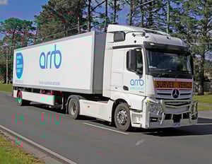
An engineering masterpiece.
Intelligent Pavement Assessment Vehicles (iPAVE) are a prime mover and trailer equipped with a heavy weight over a single rear axle.
A series of lasers mounted in the trailer measures the deflection velocity of the pavement in the left-hand wheel path as the truck travels down the road at highway speeds.
This information is used to assess the bearing capacity of the pavement. It is predominately used for state road authorities but has been utilised on some local government networks too. iPAVE vehicles can also measure roughness, texture, rutting, digital imagery for visual rating and ACD cracking.
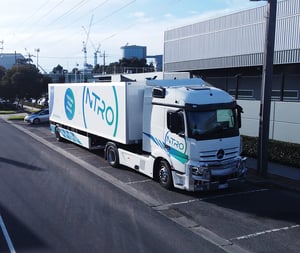
Next-generation radar technology.
It collects all data as it drives, including video imagery, to monitor the response of a pavement when placed under load. Several cameras are mounted to the iPAVE to collect asset and pavement imagery.
Data provided includes continuous pavement deflection profiles, from which bearing capacity indices can be derived and pavement fatigue estimated. The high accuracy and resolution of the iPAVE enables engineers to pin-point areas where the pavement may be subject to failure, allowing local government and road agencies the opportunity to decide where best to spend their valuable maintenance dollars.
ARRB has three iPAVE vehicles, which are available to local government and road agencies. Our third iPAVE vehicle joined the fleet in July 2022. You can find out more about our newest iPAVE, with ground penetrating radar, in the video below.